Updated by "Forest Circular Economy" Editorial Board on October 15, 2025, 8:58 PM JST
Editorial Board, Forest Circular Economy
Forestcircularity-editor
We aim to realize "Vision 2050: Japan Shines, Forest Circular Economy" promoted by the Platinum Forest Industry Initiative. We will disseminate ideas and initiatives to promote biomass chemistry, realize woody and lumbery communities, and encourage innovation in the forestry industry in order to fully utilize forest resources to decarbonize the economy, strengthen economic security, and create local communities.
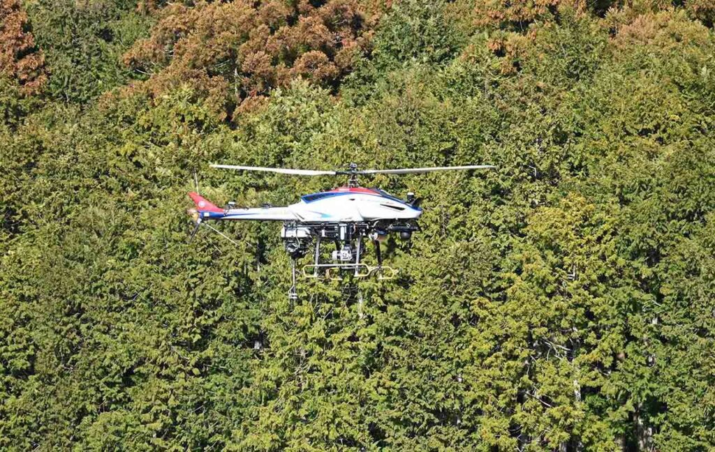
Oji Holdings, Yamaha Motor, and Precision Forestry Measurement announced on October 14 that they have started a joint verification experiment on the acquisition and analysis of forest information using remote sensing. The aim is to acquire detailed forest information in single-tree units to make forestry smarter and improve the accuracy and efficiency of operations.
The shortage of labor and the aging of the workforce in the forestry industry are serious issues. In particular, Japanese forests, with their vast and complex topography, require a great deal of labor to conduct field surveys to accurately determine the volume of resources. This joint verification experiment is part of the forestry DX program to solve these issues, and will be conducted in several company-owned forests in Japan owned by the Oji Group.
In the verification experiment, Yamaha Motor's unmanned industrial helicopter will perform wide-area laser measurements, and the high-density point cloud data obtained will be analyzed by Precision Forestry Measurement. This enables the visualization of forest resource components such as tree species, height, diameter, timber volume, and location.
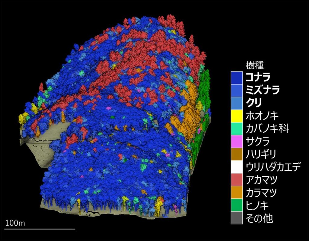

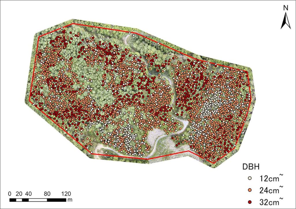
If this approach is put to practical use, it will lead to significant labor savings and safety improvements in field surveys, as well as enable precise, data-driven forest management. Accurate knowledge of the distribution of tree species and the location of large-diameter trees according to topography and water systems will improve the accuracy of forest maintenance, such as planned harvesting and afforestation. In the future, the company plans to expand the system to CO2 fixation calculation and the J-credit system.
Advanced analysis of forest resources is not only valuable for timber utilization, but also contributes to the improvement of the accuracy of forest maintenance and resource management, as well as ecosystem conservation. Accurate data is an indispensable foundation for sustainable forest management, and the joint demonstration is expected to make significant progress in achieving this goal.
